Expertise in ESRI and Open Source Technologies like Geoserver, Google Maps API
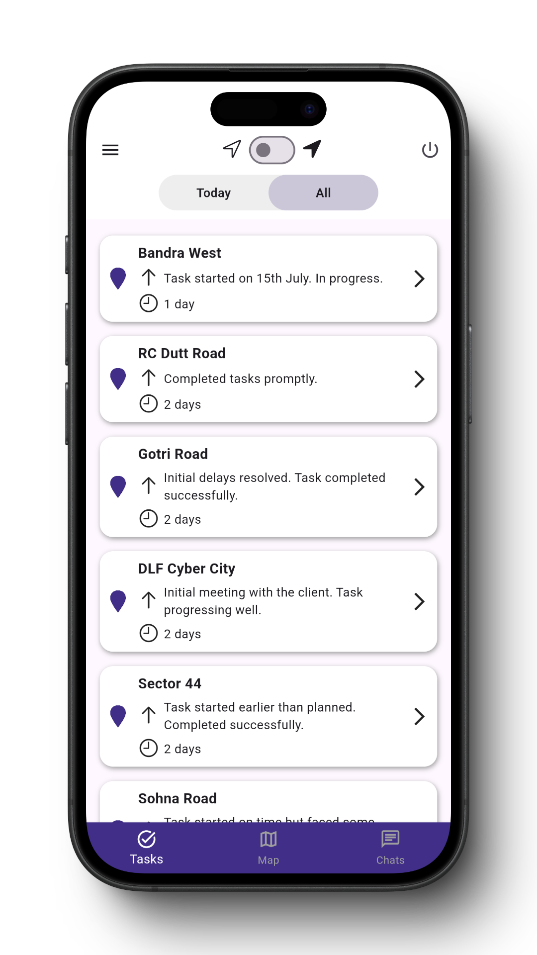
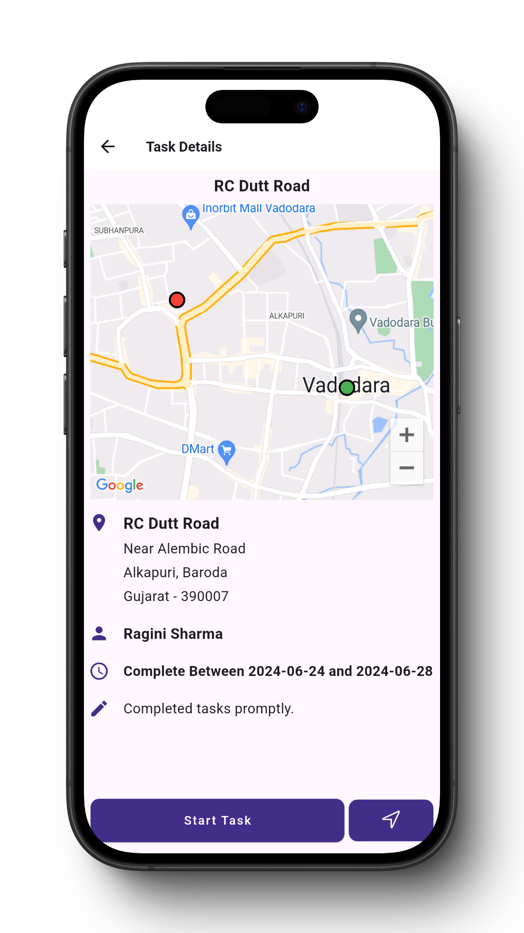
Precise Location tracking and Analytics. Improved Fieldforce productivity and better ROI
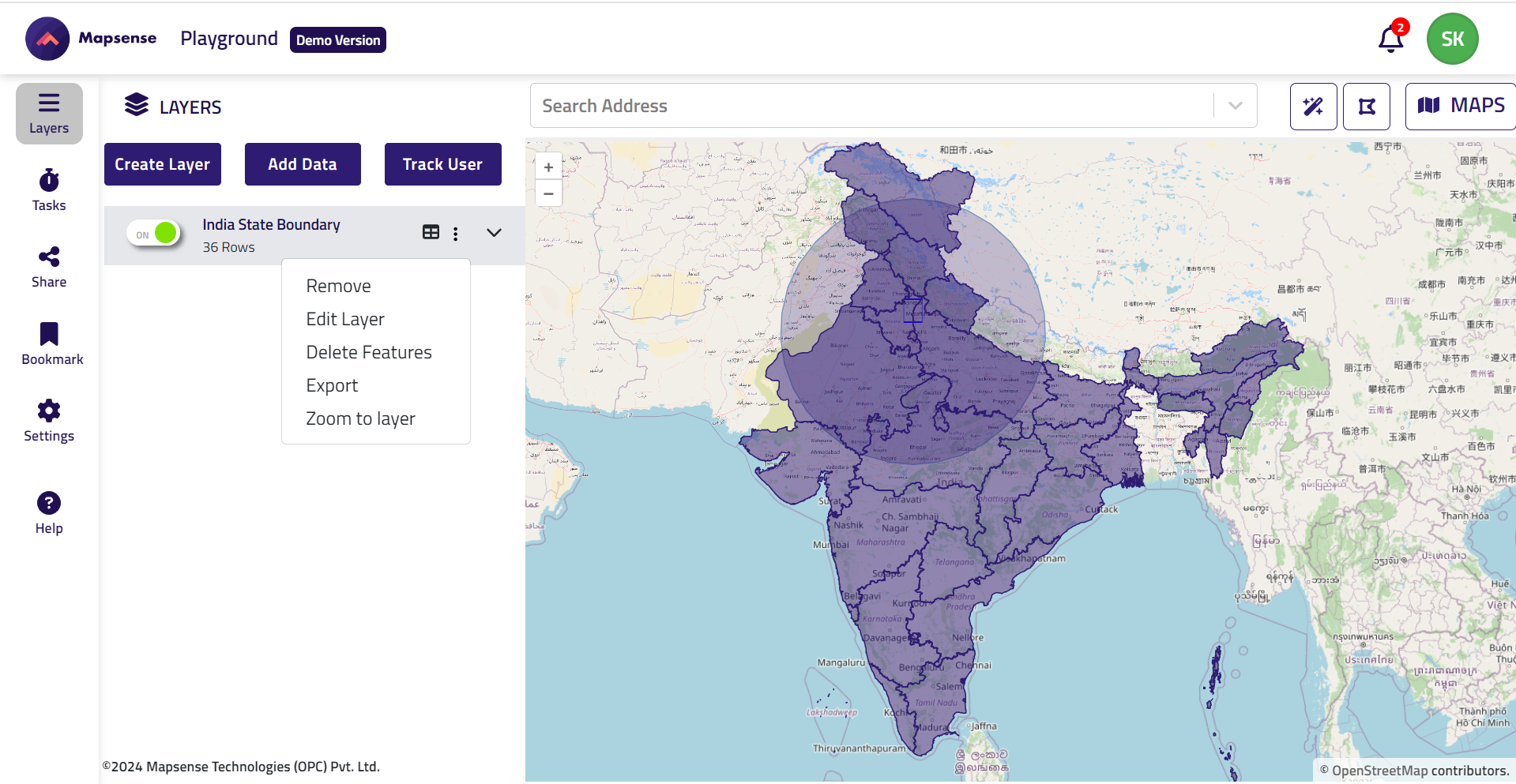
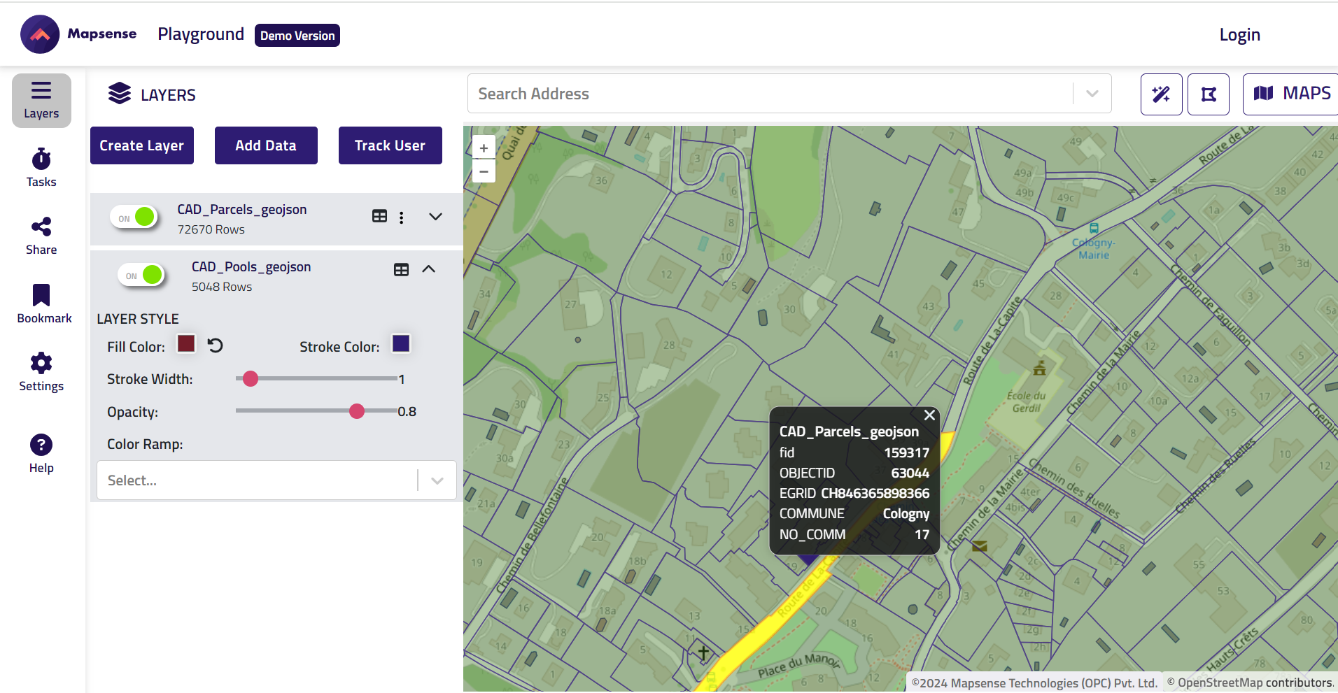
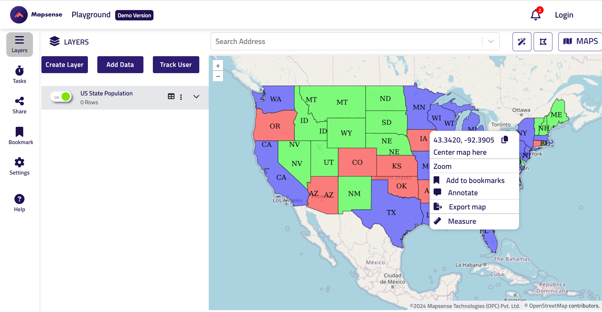
Build GIS applications for the Cloud. Access Openstreet data from the application
Geo enable, enrich your data for better business insights and improved decision making
Product Development services using a variety technology stack


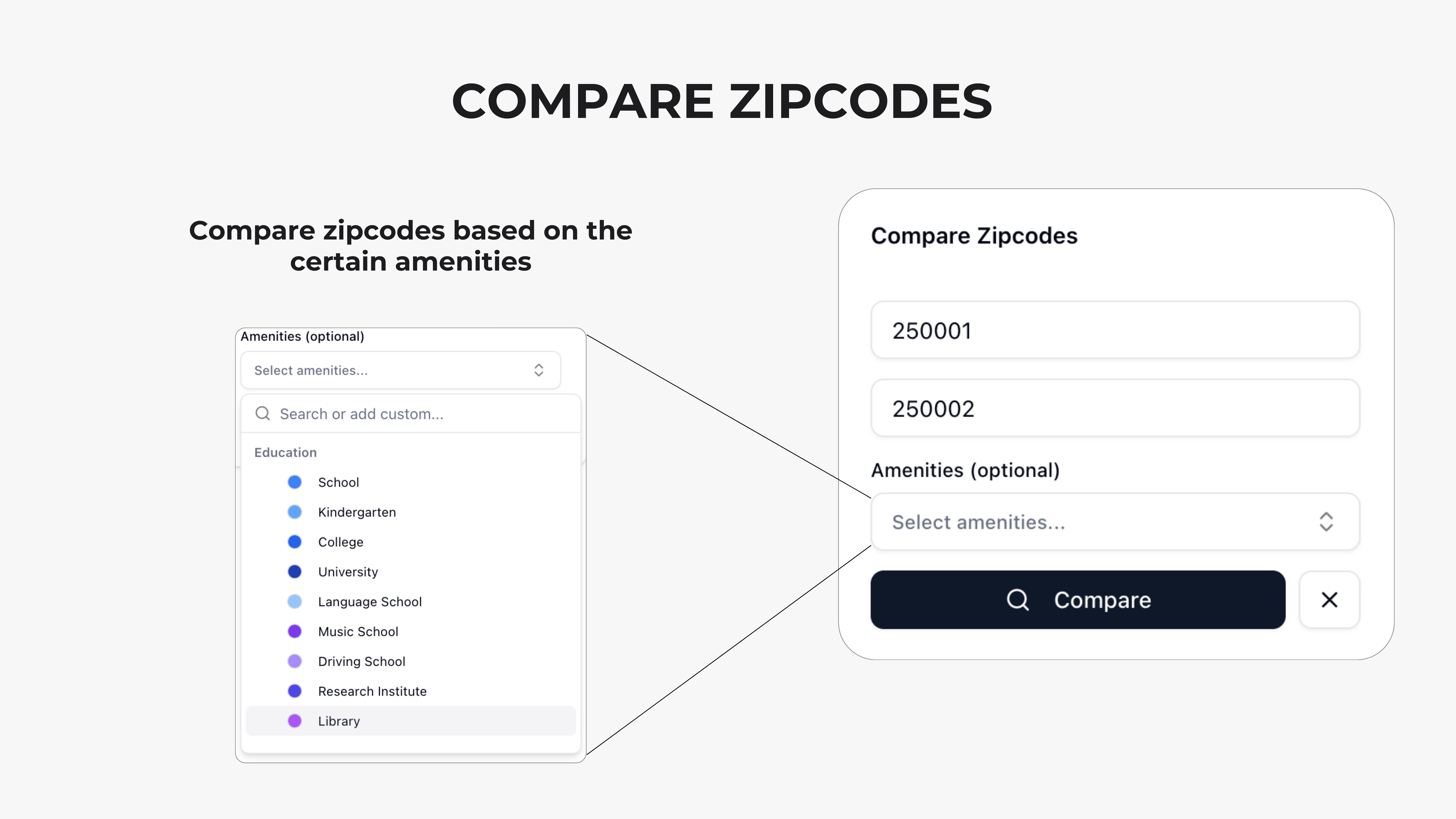
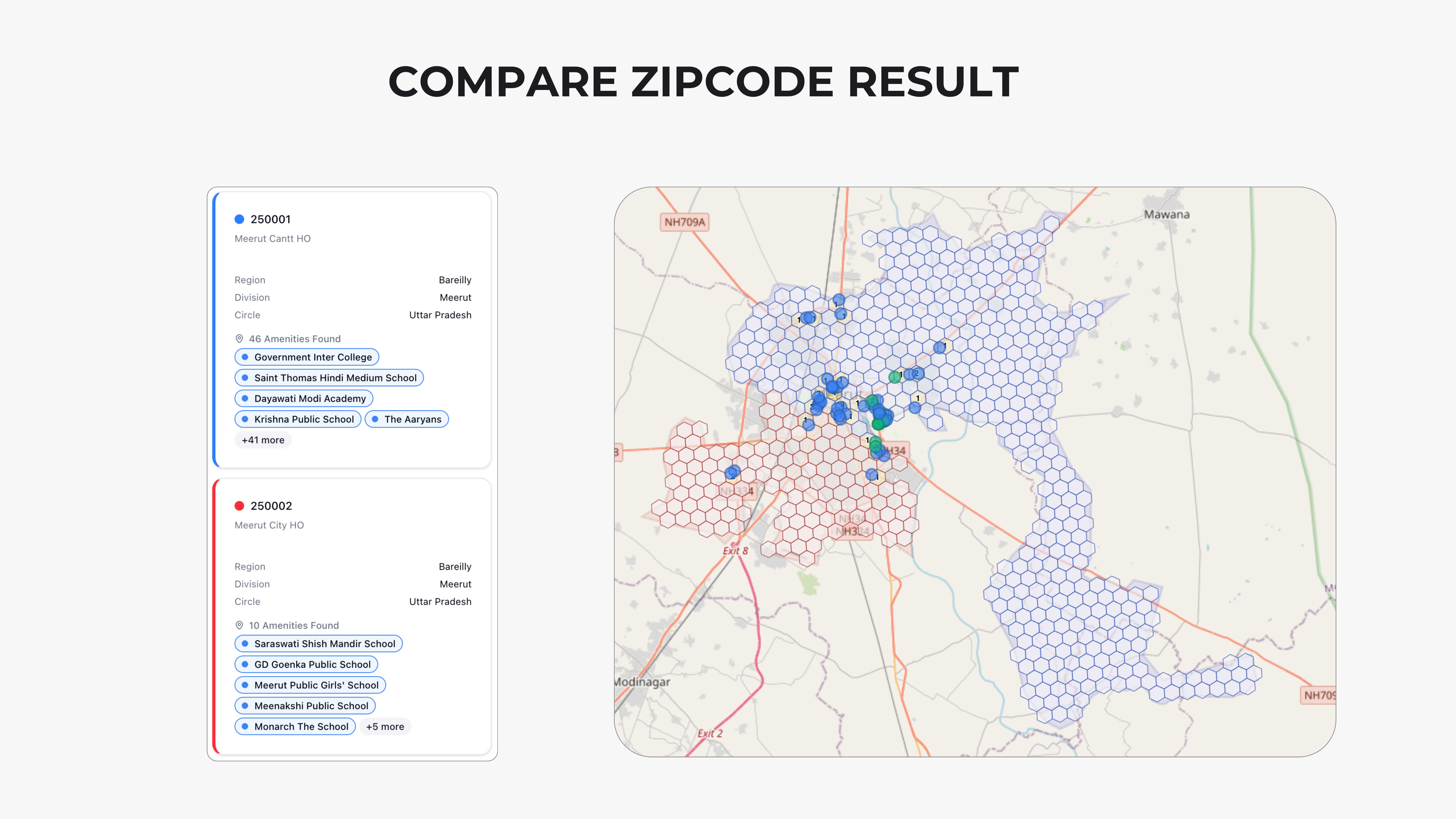
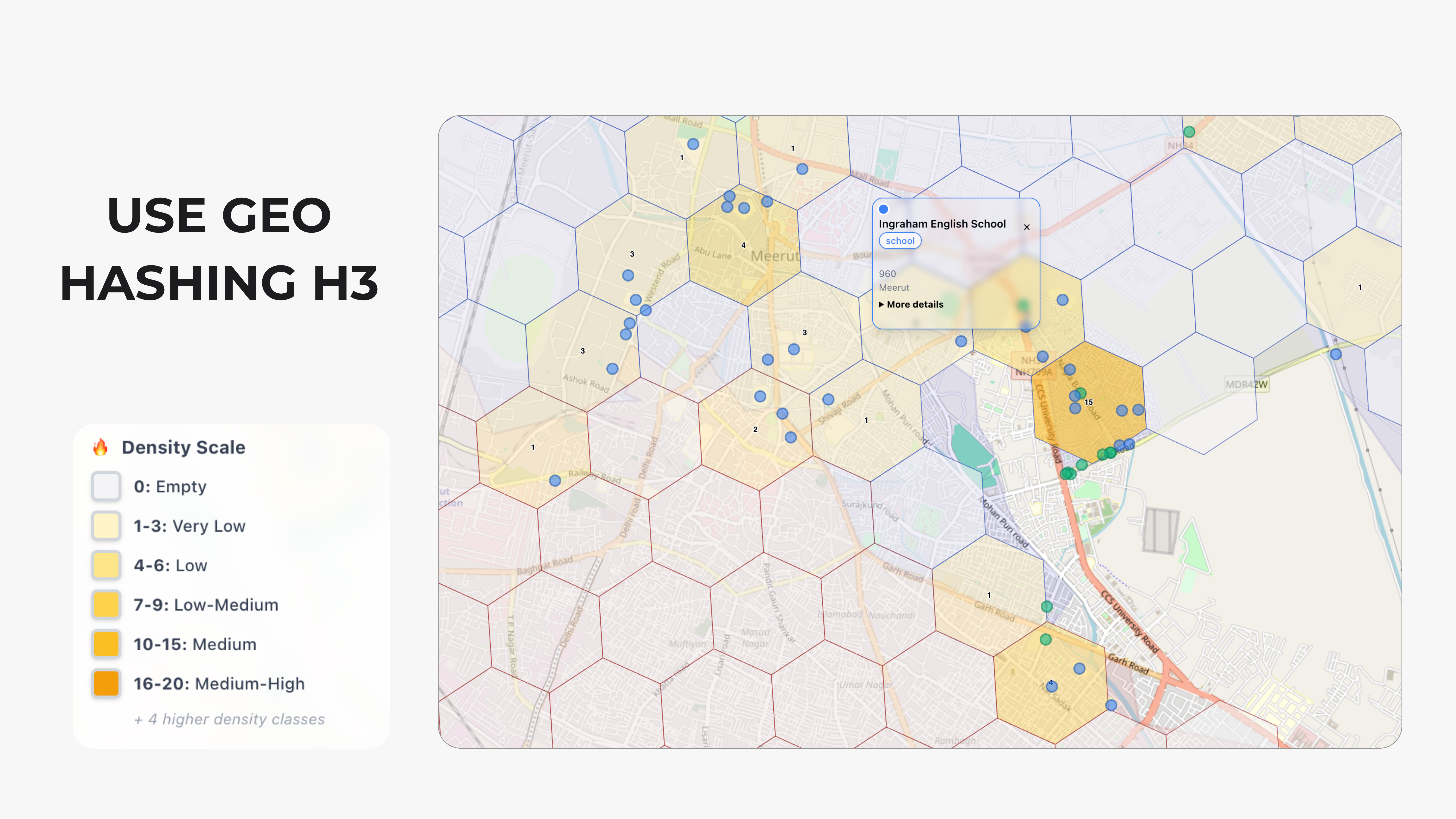
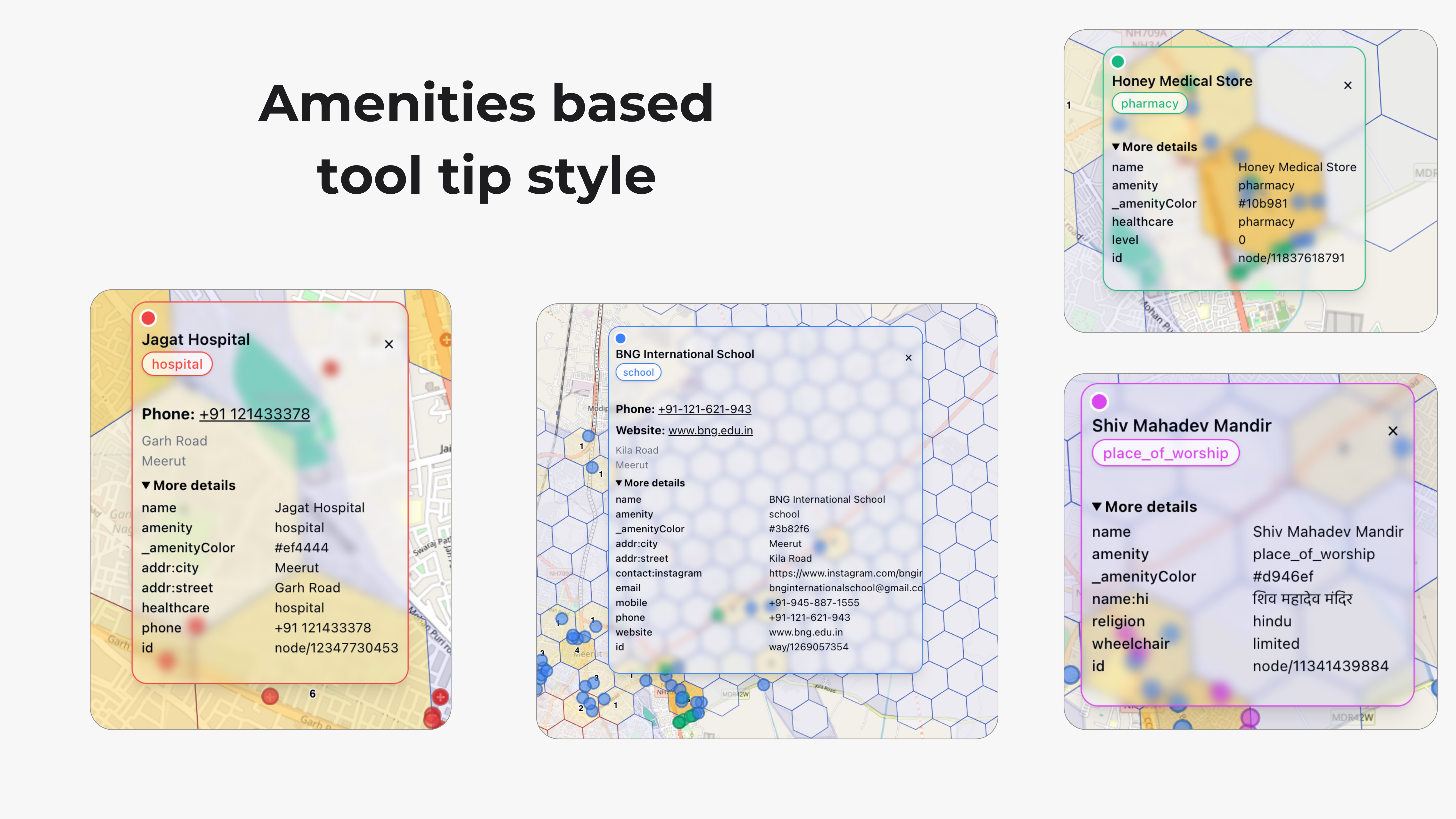
AI-Powered Geo-Analysis for smarter location insights
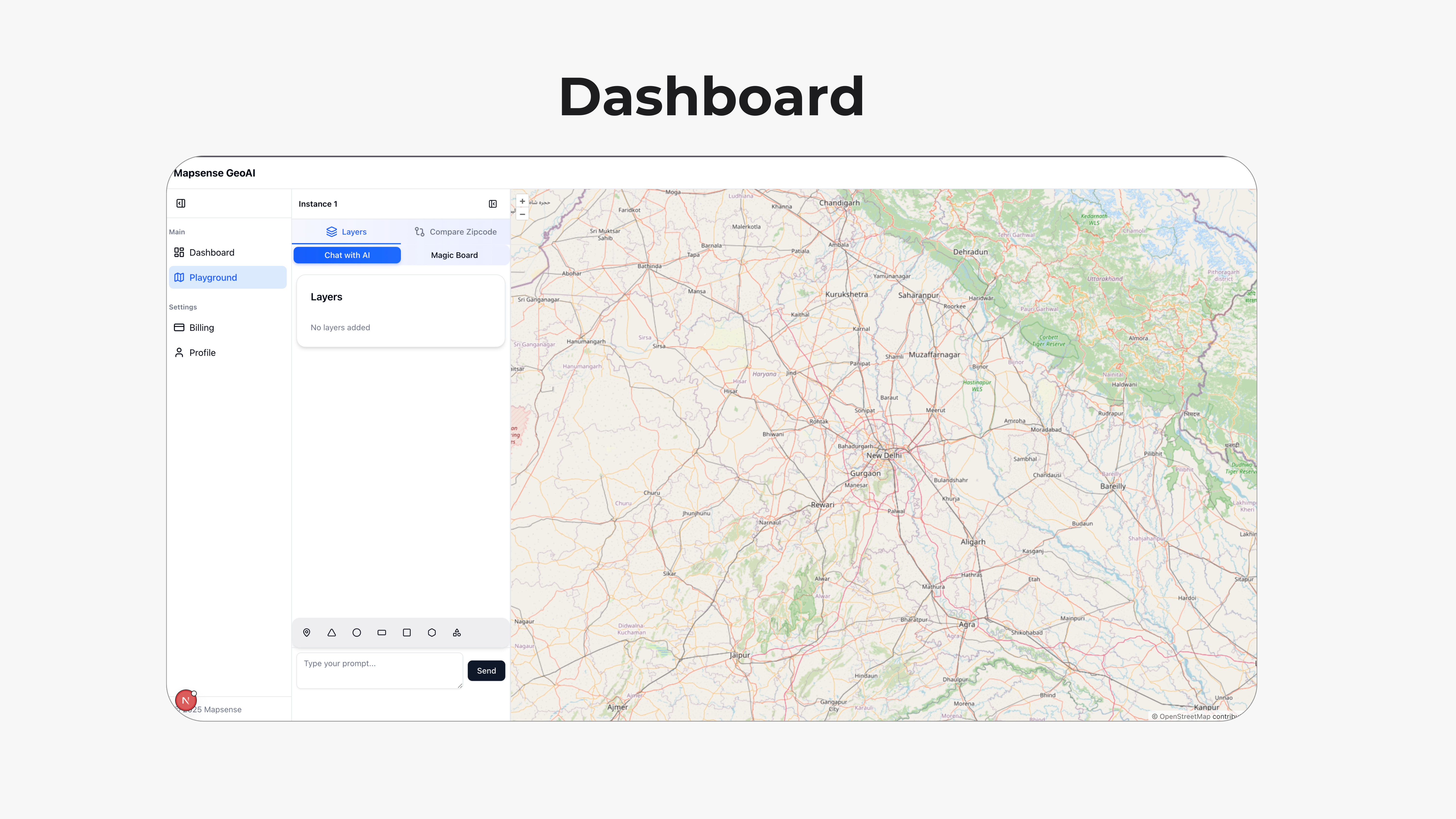
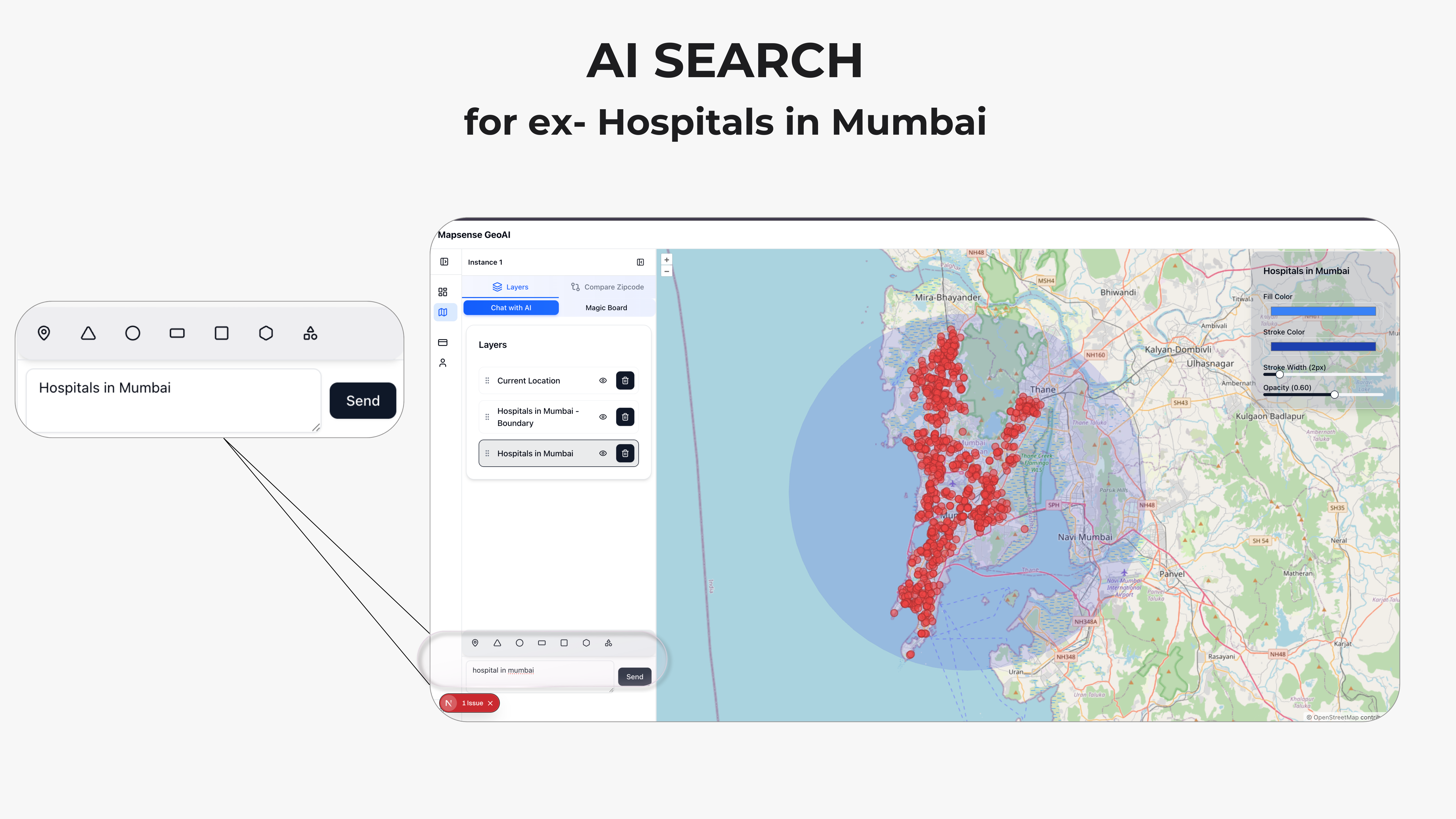
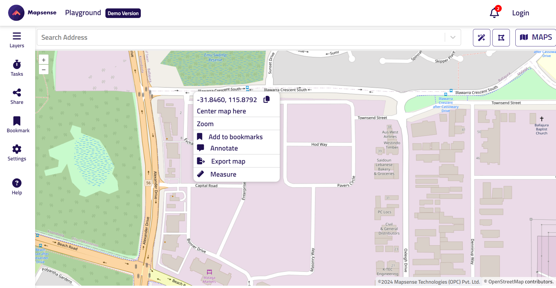
Geospatial Data Visualization & Styling Platform
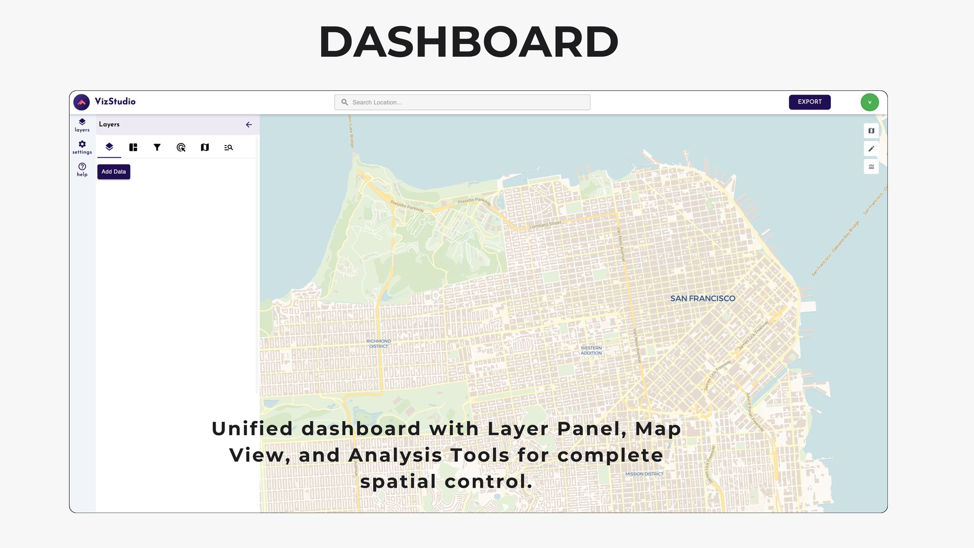
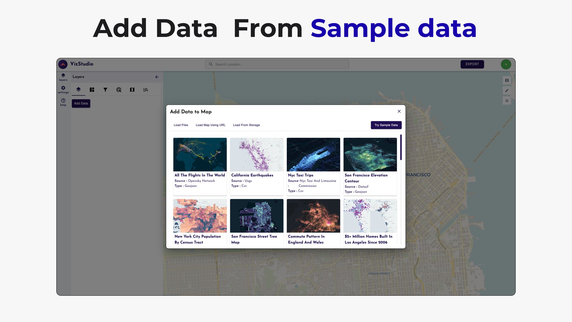
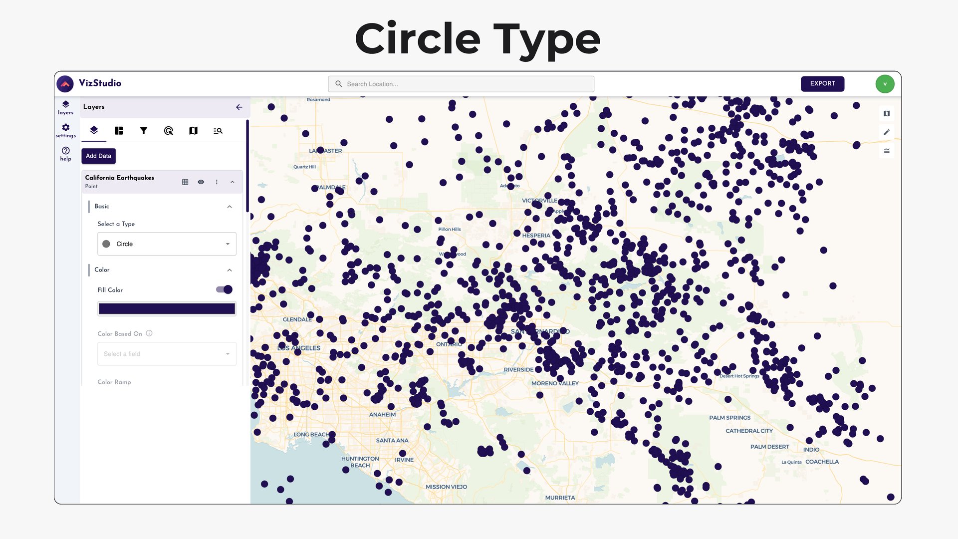

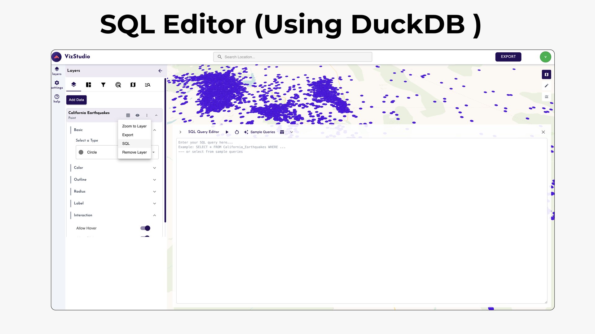

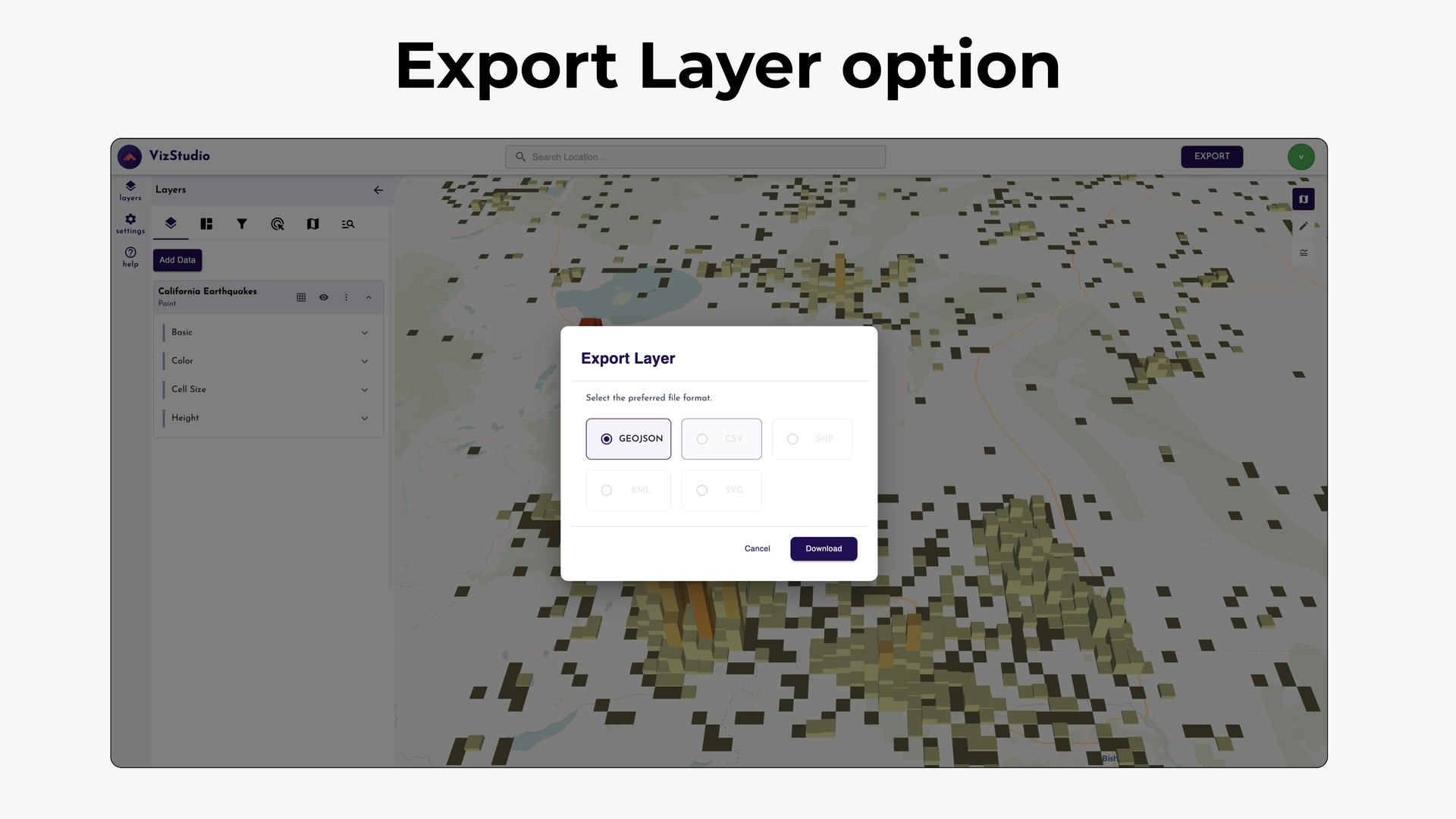
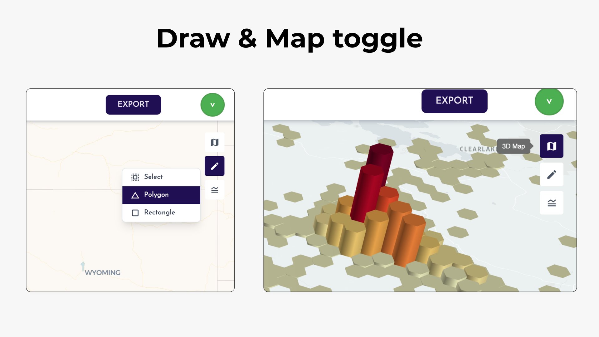
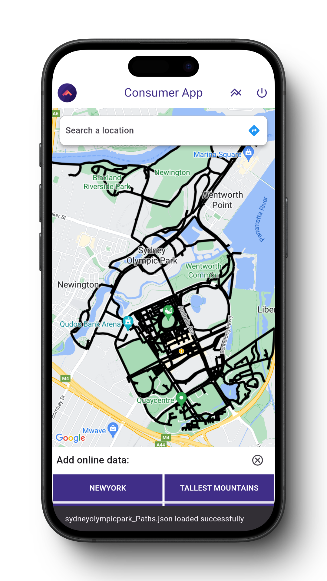
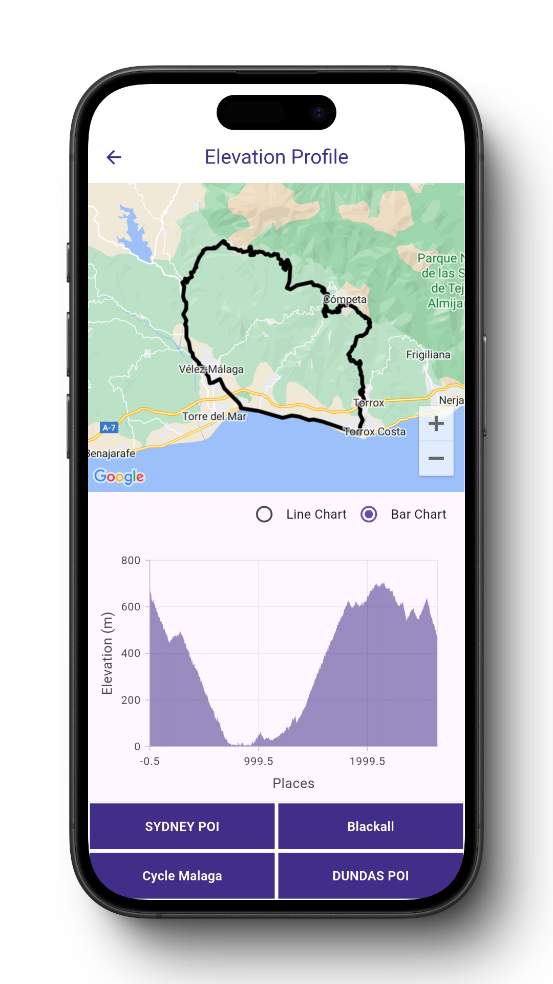
Geospatial data visualization and editing on the web
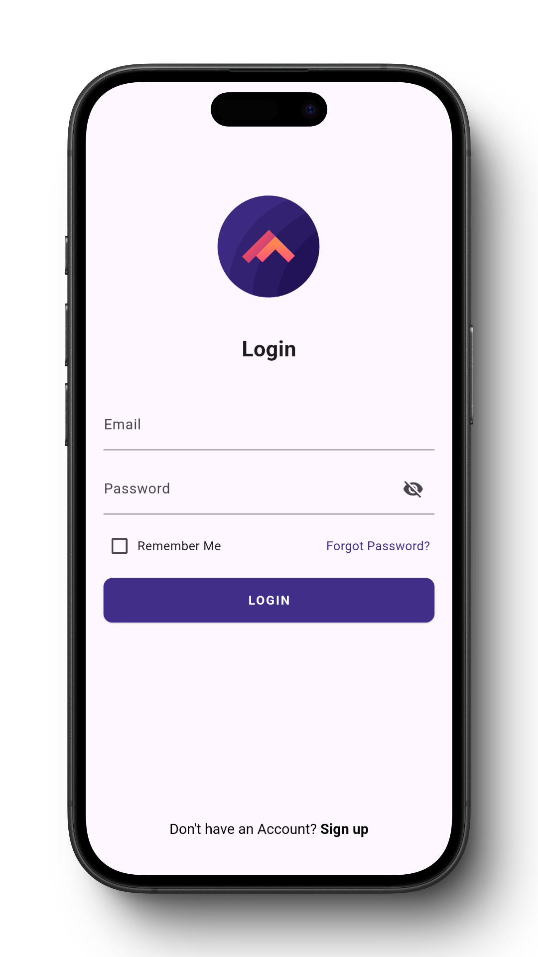
Hypertrack is a multi-purpose field force and asset tracking Mobile App for Android.
Fieldsense is an outdoor navigation and planning App for Android. Explore from a vast set of curated outdoor experiences or contribute to the community
Key solutions built by Mapsense
Store Locator offers highly customizable maps with custom markers and geolocation, allowing you to tailor the map design to your brand's needs. It enables easy integration of store locations, interactive search, and driving directions, providing an engaging and efficient way for users to find nearby stores
A GIS based dashboard to track and study the impact of mining and construction activities to the biodiversity
Customize design and data management as per your needs
Solution deployed on your private/cloud servers
Indoor navigation solution for an event management company
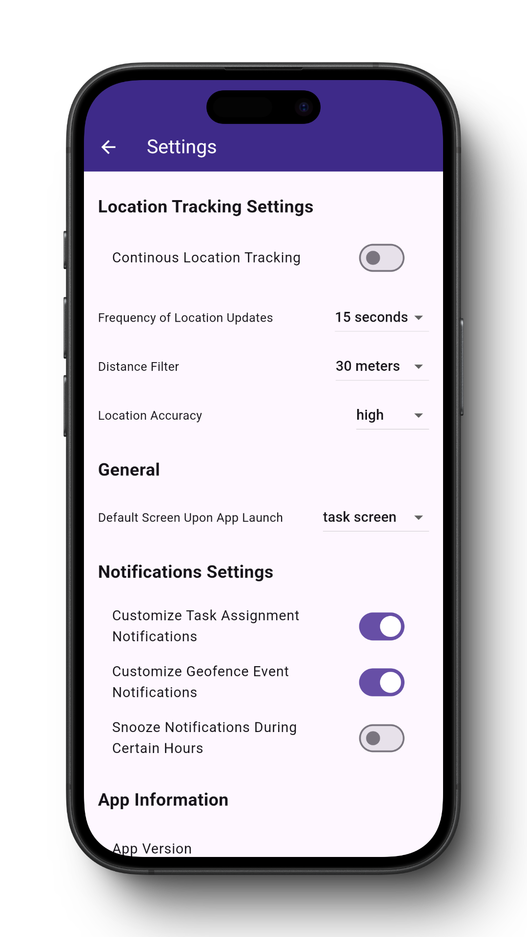
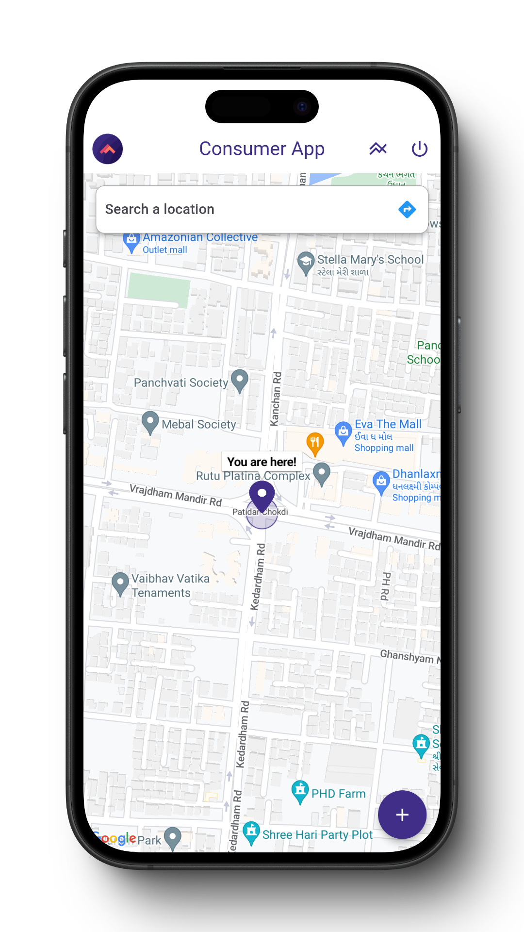
Field force tracking and data collection app provide you real time tracking and actual path travelled
Customer satisfaction through product and execution excellence
phone
+91-9319246002
contactus@mapsense.in
location_on
Gurgaon, Haryana, India